Baise Travel Guide
Baise in Guangxi is a land of karst wonders, with the Dashiwei Tiankeng Group, Tongling Grand Canyon, waterside spots like Equan and Haokun, and Zhuang culture.
Baise Travel guide
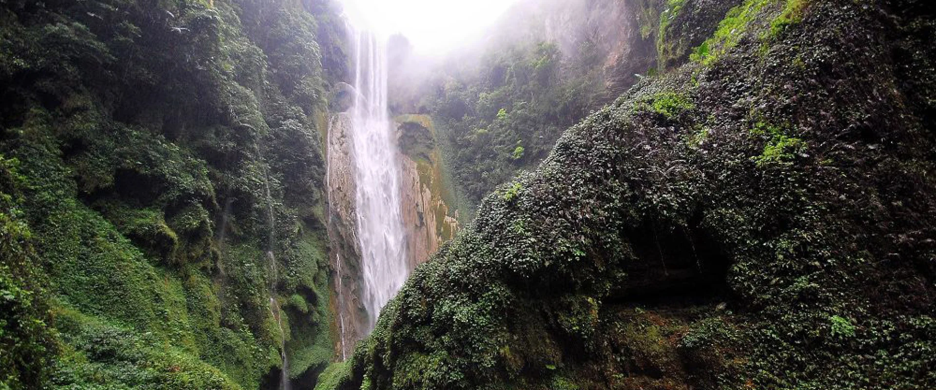
Baise lies in the west of the Guangxi Zhuang Autonomous Region, a mountainous region close to Yunnan Province and Vietnam. Mountains with well-developed karst scenery run in ranges, and deep canyons and underground caves are often seen. The area is wide and holds terrain rich in variety.In Leye in the north lies the Dashiwei Tiankeng Group. Limestone dissolved and collapsed to form the huge depressions called tiankeng, and their scale and number are rare even in the world. This area is part of the Leye-Fengshan Global Geopark and draws attention in geological research as well. At the bottom of the tiankengs, forests of their own grow, home to rare plants and animals.In Jingxi in the south lies the Tongling Grand Canyon, where the Tongling Waterfall with its large drop plunges into the depths of the valley. The canyon is covered in forest with many rare plants, and strolling can be enjoyed together with the scenery of caves and underground rivers. Waterside spots such as Equan Spring and Haokun Lake also stand here and there.Baise is a multi-ethnic region with a large Zhuang population, where distinctive costumes and song cultures, including those of the black-clad Zhuang of Napo, are preserved. High-speed rail runs from Nanning, and from the center you head to each scenic area by car. It is a land on a grand scale, with scenery spreading both below the ground and above.
Photos of Baise
Baise Essential information
Best time to visit
Summer brings much rain; the water in the canyons swells and the falls gain force, but the heat and humidity turn severe as well. From autumn through spring temperatures settle, suiting strolls to the tiankengs and canyons. The caves stay cool through the year, so a jacket is reassuring.
Weather and climate
The climate is subtropical, warm with much rain, and the hills are on the humid side. Summer brings frequent squalls, and winter rarely turns cold. Canyons and caves are chilly, so clothing that can adjust to temperature helps. On days of strong sun, a light long-sleeved layer is reassuring.
Local food
Baise is known as a fruit-producing region, and mangoes come to market in abundance in summer. Rice-noodle dishes and dishes of fish from the rivers are everyday tastes, and the sour cooking of the neighboring peoples is well loved as well. Trying the fruits and snacks at the markets is a pleasure found only here.
Getting there and around
High-speed rail runs to Baise from Nanning, and within the city you move by local bus and car. Leye and Jingxi lie far across the wide area, and moving to the scenic spots is mainly by car, so allow time for travel. In areas close to the Vietnam border, follow local guidance when moving about.
Travel tips
The tiankengs and canyons involve long walks, with slippery stretches, so comfortable shoes are a must. In summer prepare rain gear and insect repellent. The caves are cool inside, so a light jacket is reassuring. Be ready for both strong sun and sudden rain.
Baise Monthly climate
Typical monthly temperatures and rainfall based on historical climate records.
Jan
- Avg. high
- 18℃
- Avg. low
- 10℃
- Rainfall
- 19mm
Feb
- Avg. high
- 20℃
- Avg. low
- 12℃
- Rainfall
- 20.5mm
Mar
- Avg. high
- 25℃
- Avg. low
- 15℃
- Rainfall
- 33.1mm
Apr
- Avg. high
- 29℃
- Avg. low
- 20℃
- Rainfall
- 61.7mm
May
- Avg. high
- 32℃
- Avg. low
- 23℃
- Rainfall
- 156.7mm
Jun
- Avg. high
- 33℃
- Avg. low
- 24℃
- Rainfall
- 195.9mm
Jul
- Avg. high
- 34℃
- Avg. low
- 25℃
- Rainfall
- 190.3mm
Aug
- Avg. high
- 33℃
- Avg. low
- 24℃
- Rainfall
- 184.8mm
Sep
- Avg. high
- 32℃
- Avg. low
- 22℃
- Rainfall
- 108.1mm
Oct
- Avg. high
- 29℃
- Avg. low
- 19℃
- Rainfall
- 73.4mm
Nov
- Avg. high
- 24℃
- Avg. low
- 15℃
- Rainfall
- 35.9mm
Dec
- Avg. high
- 20℃
- Avg. low
- 11℃
- Rainfall
- 15.3mm
Historical climate averages for planning only. This is not a weather forecast.